Google Earth Studio
Google Earth Studio is a cloud-based tool for creating geospatial data-backed videos. Its applications span multiple industries, offering a versatile platform for mapping, tour design, and video production. It is a resourceful tool for traffic simulations and 3D imagery productions.
概要
Google Earth Studio
Google Earth Studio is an innovative tool designed for motion graphics.
With high-fidelity rendering capability, it allows you to create outstanding videos directly from geospatial data.
Major applications include mapping, tours, video production and traffic simulation.
Equipped with robust customization and control over the camera angles, it is an essential tool for visual storytellers.
Besides, it facilitates easy integration with commonly used video production tools for seamless workflow.
It leverages Google Earth's huge repository of 3D imagery and the power of cloud computing to provide unrivaled geographical storytelling tool.
This product doesn't require installation and is accessible directly through the web browser.
スクリーンショット

ツールへのリンク
以下のリンクから問題の解決策をご覧ください。
外部リソース
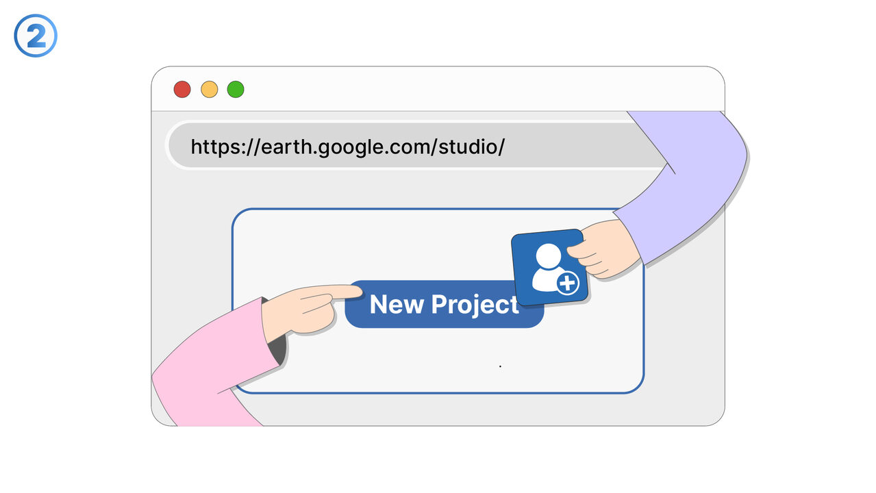
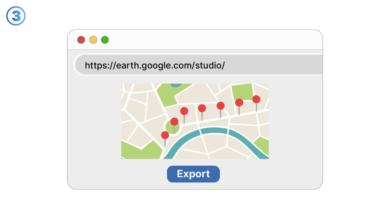
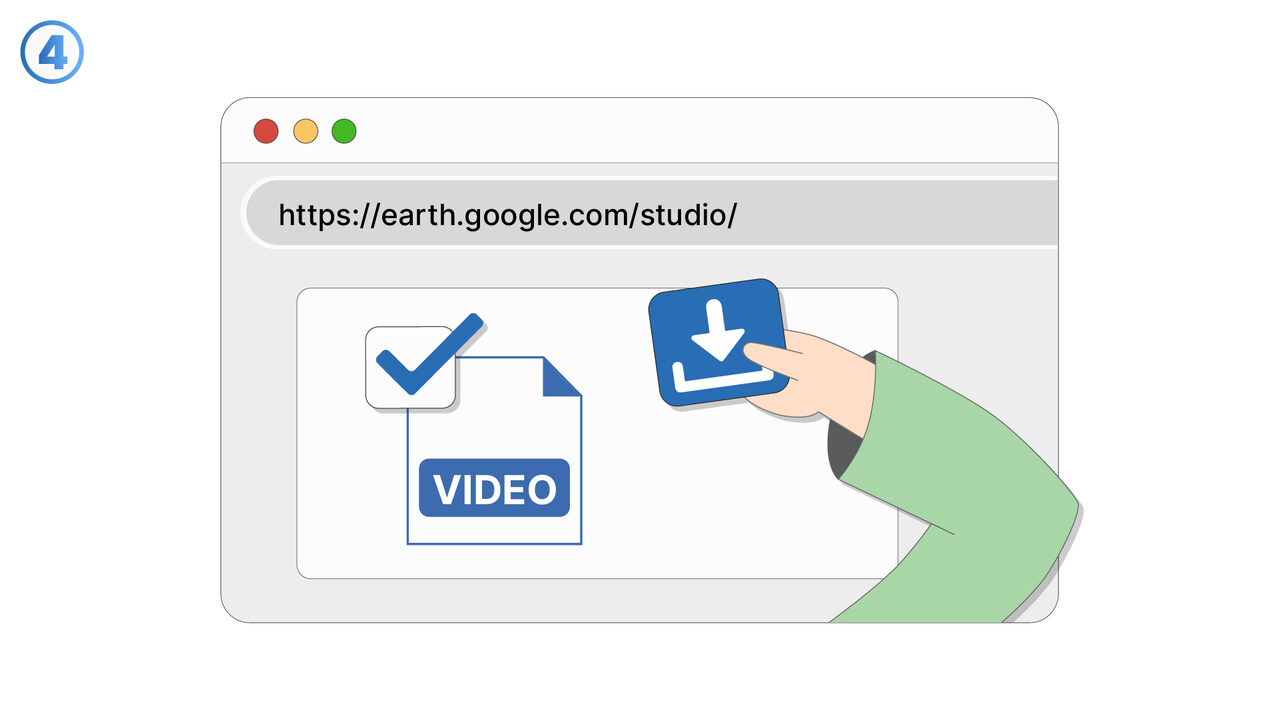
https://earth.google.com/studio/
新しいタブで開きます — MangoByte と提携していない外部サイトです
以下の問題の解決策としてこのツールをご活用ください
- I have problems creating videos that are based on geographical data.
- I need a tool to use high-quality 3D images for geographical storytelling in my videos.
- I have difficulties creating convincing virtual tours.
- I am having problems with the simulation of traffic flows with Google Earth Studio.
- I am having difficulties integrating geographic productions seamlessly into my usual production tools.
- I need a program to map complex geographical data in detail.
- I have trouble controlling the camera angles in my 3D graphics.
- I can't export 3D graphic videos with Google Earth Studio.
- I'm having trouble creating videos with high-resolution graphics in Google Earth Studio.
- I am having trouble visualizing geographical data in 3D.
より良い解決策をご存知ですか? お知らせください。
まだ取り上げていない問題を解決できるツールやアプローチをご存知でしたら、ぜひお知らせください。